 Wayfenn
Your photographs.
Their place on the path.
Bring camera JPEGs and a timed GPX. Review the camera clock, see which photos match, and take away new JPEG copies with GPS metadata.
One purchase · US $5.99
Submitted pricing may vary by region. App Store availability follows Apple's review. No subscription or account.
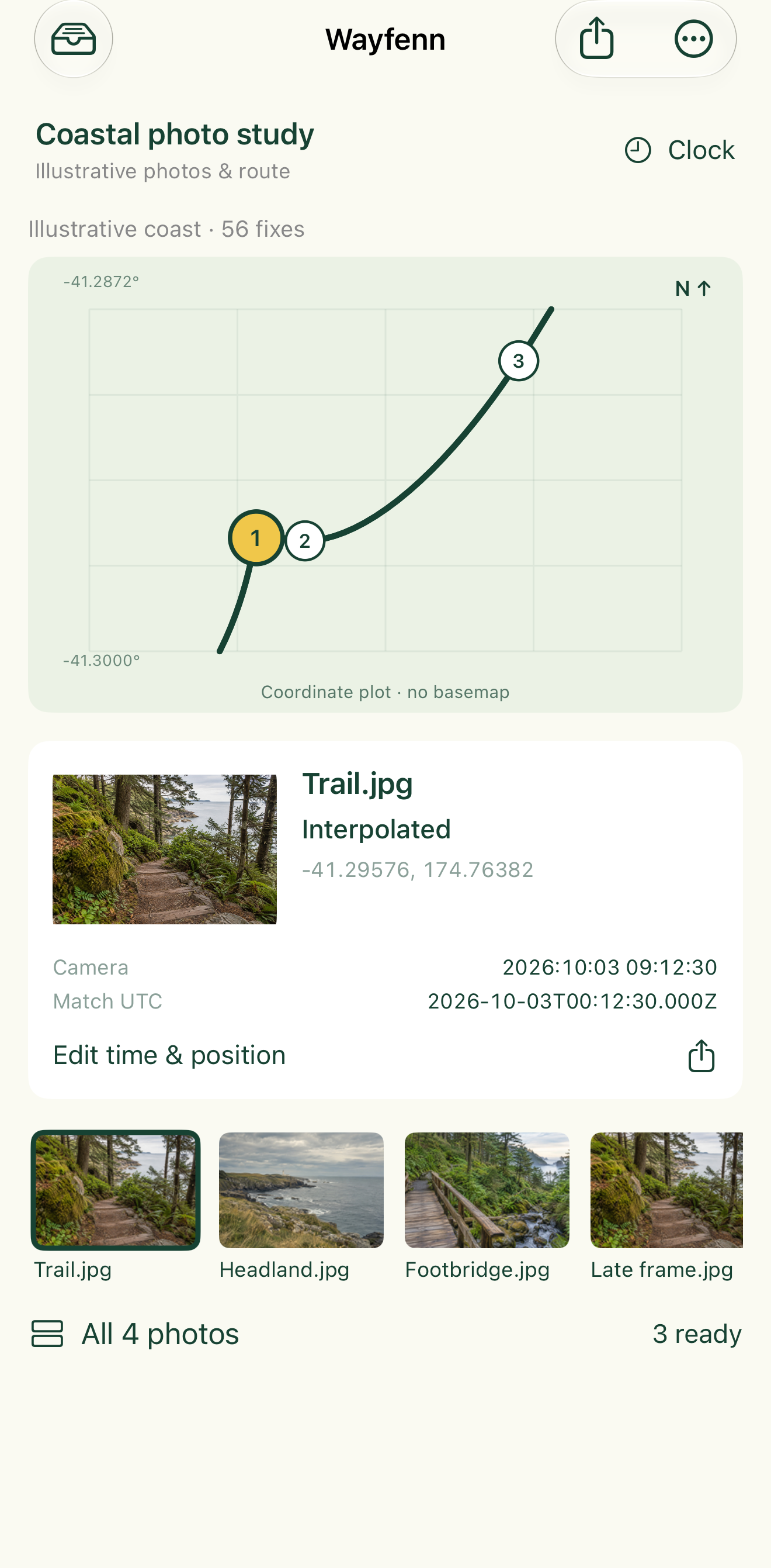
From files to positioned photographs.
01 / Bring your track and photos
Open JPEGs and GPX through Files. Wayfenn retains private source copies in a local trip. External originals are never edited.
02 / Review the clock and gaps
Set a fallback timezone and signed clock correction. Photos outside the track or across segment breaks stay unmatched. Adjust individual UTC times or positions when needed.
03 / Export files you can use
Share GPS-tagged JPEG copies plus CSV, GPX, GeoJSON and a photographic PDF report. Every GPS write checks that the compressed JPEG image stream is unchanged.
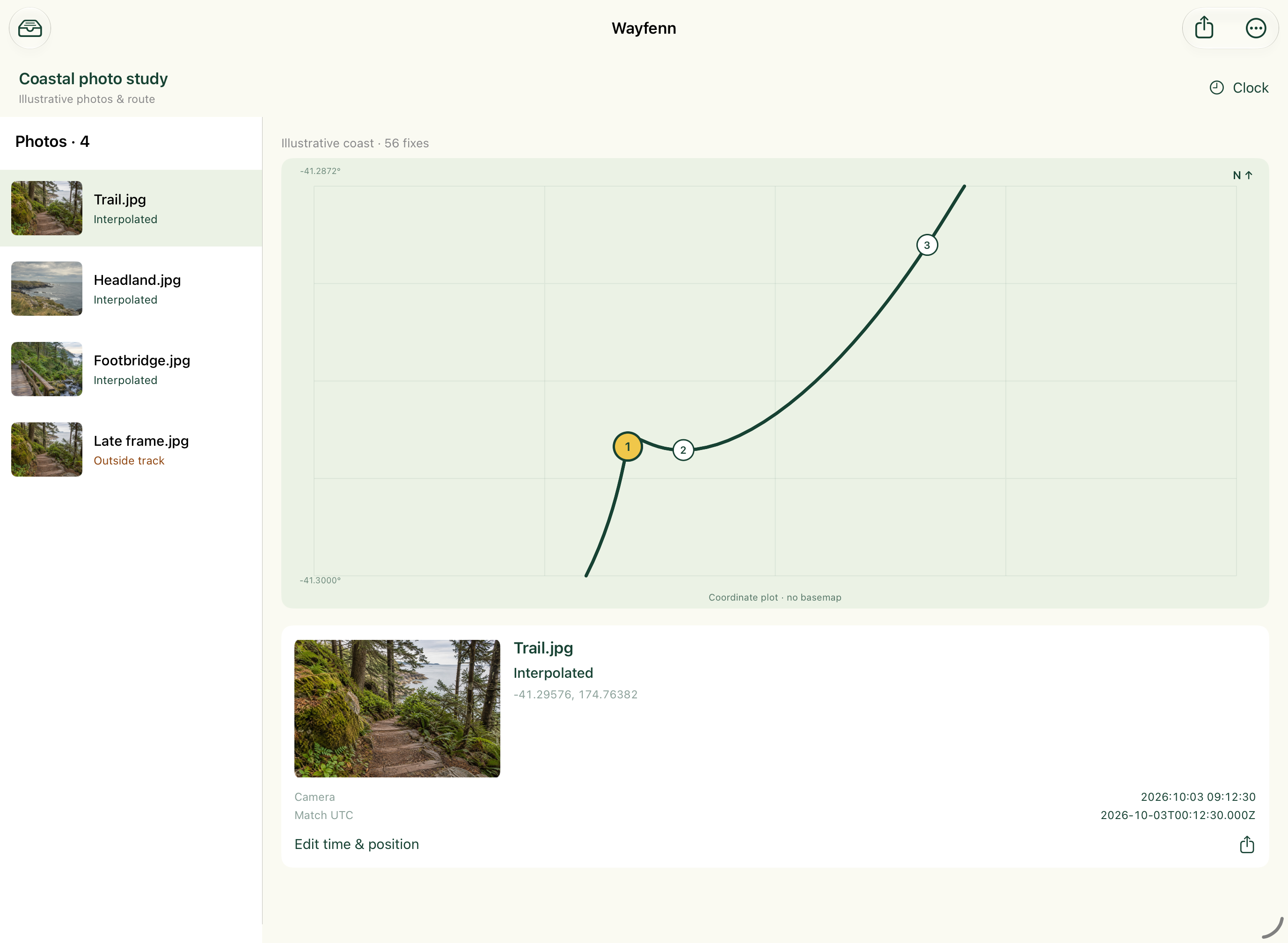
A broad workspace on iPad.
Your photograph list remains beside the north-up route plot. Select a frame and inspect its source timestamp, interpreted UTC and location in one place.
What leaves the app.
| Tagged JPEGs | Selected photos with resolved positions, written as new copies. Capture dates stay unchanged; matching UTC becomes GPS time. Existing GPS is preserved by default. |
|---|---|
| Matches.csv | A decision row for every retained photo, including unmatched and excluded photographs, UTC, position and interpolation details. |
| GPX & GeoJSON | Photo waypoints and route geometry in WGS84 coordinates for use in compatible tools. |
| PDF & manifest | A photographic report, settings record, readme and SHA256 checksums. Preview the real PDF or share the full ZIP through the system sheet. |
Support
Email maga40@naver.com. Include your device, iOS version and the step that failed. Do not send private photos or location tracks unless you choose to include them.
Supported files and limits
Single JPEG stills up to 40 megapixels and 50 MiB; 100 photos per trip. UTF-8 GPX 1.0/1.1 timed track points, up to 2 MiB and 50,000 points with strictly increasing timestamps across segments. Untimed points are ignored. GPX routes and standalone waypoints are not matched. Local library: 20 trips, 250 MiB sources per trip and 1 GiB total.
How do I set the camera clock?
The fallback timezone is minutes from UTC: +09:00 is 540 minutes. An embedded EXIF timezone takes priority. Add a signed correction in seconds; positive shifts matching later, negative earlier. Explicit per-photo UTC overrides bypass both. Matching settings never rewrite original JPEG capture dates.
Why is a photograph unmatched?
It may have no usable capture time, fall outside the timed track, cross a segment boundary, or sit between fixes further apart than your maximum gap. Review the timestamp, track and settings. A manual WGS84 position can be entered when you know where the photograph belongs.
What is outside this version?
RAW, HEIC and PNG editing; camera capture; GPS recording; navigation; basemaps; geocoding; Photos-library editing; cloud sync. Proprietary MakerNotes and unknown metadata fields are not guaranteed. Keep originals and GPX backed up separately.
Privacy policy
Effective October 3, 2026. Wayfenn is provided by Gobling Company.
We do not collect, receive, sell or track your app data. Wayfenn has no developer upload service, analytics, advertising SDK or account. Processing runs locally on your device.
Files you select, including photographs, their metadata, precise coordinates and GPX track points, are copied into private app storage to perform matching and retain trips. The app does not request live location, camera or Photos-library access. System Files providers may have their own policies.
You can rename, remove photos or delete trips. Removing the app removes its local storage. iOS device backups and external Files providers may retain copies under your own settings and their policies.
Exports contain photographs and precise locations. Only the destinations you choose through the system share sheet receive those files. Export caches may be cleared by iOS. Save important output and back up sources before deleting trips or the app.
If you contact support, we receive the message and attachments you choose to send and use them to answer your request. Apple handles purchases under its own privacy policy. Contact: maga40@naver.com.
Terms & use
Use files you own or have permission to process. Interpolated coordinates estimate the logger's position between timed fixes; they do not certify the subject's location or GPS accuracy. Do not rely on this app for navigation, emergencies, legal location evidence or safety-critical decisions.
The app is sold as a one-time purchase; store pricing, refunds and purchase terms are handled by Apple. Usage is subject to Apple's Standard Licensed Application End User License Agreement. Support and feature scope are described above. No promise is made to preserve every proprietary metadata field. Review exports and retain separate original-file backups.